June 21, 2008
Molten Stockholm
hitta.se 3D is a 3D map interface that allows you to fly above Stockholm. While not too unlike other map applications I really liked the combination of aerial photo mapped on altimetry: the city is a real 3D model.
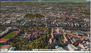
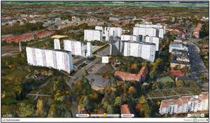
Like all modern map apps it loads data in realtime, which produces an interesting "molten" effect on many buildings and places when zoomed in too close. Or sometimes makes them look like ruins, like my own native Hagalund.
The biggest amusement was the altitude censorship at the Stockholm police headquarters. They are flat.
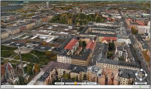
I wonder when people who wish to hide information will learn that usually it is better to blend in than to stand out? I have found military installations I would otherwise never have suspected simply because of their censorship in Google maps. In the case of the police headquarters maybe the goal was to prevent criminals from figuring out something about helicopter access, roof escapes, reactor exhausts or something similar - a clear pointer that there is something to consider there.
Posted by Anders3 at June 21, 2008 09:25 PM