Oct 17: I have created a simple applet to display some of the data interactively.
20,000 ly - the large structure of the arm and the neighboring Perseus arm (left) and Sagittarius arm (right) can be seen. Eta Carina is near the lower middle border.
2000 ly - with stars of absolute magnitude below -2 (from the Yale Bright Stars Catalog).
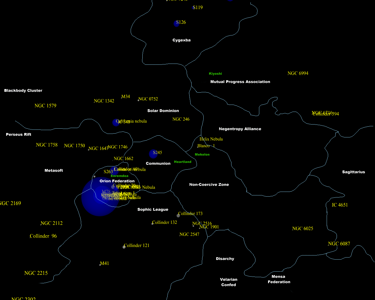
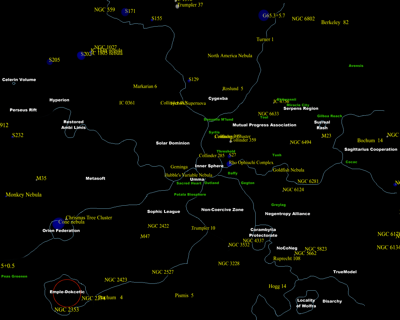
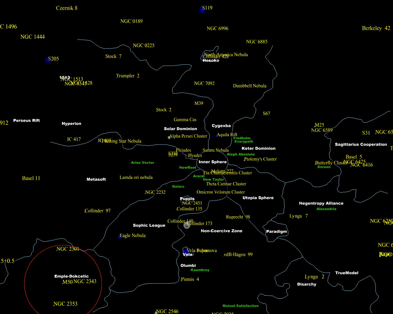
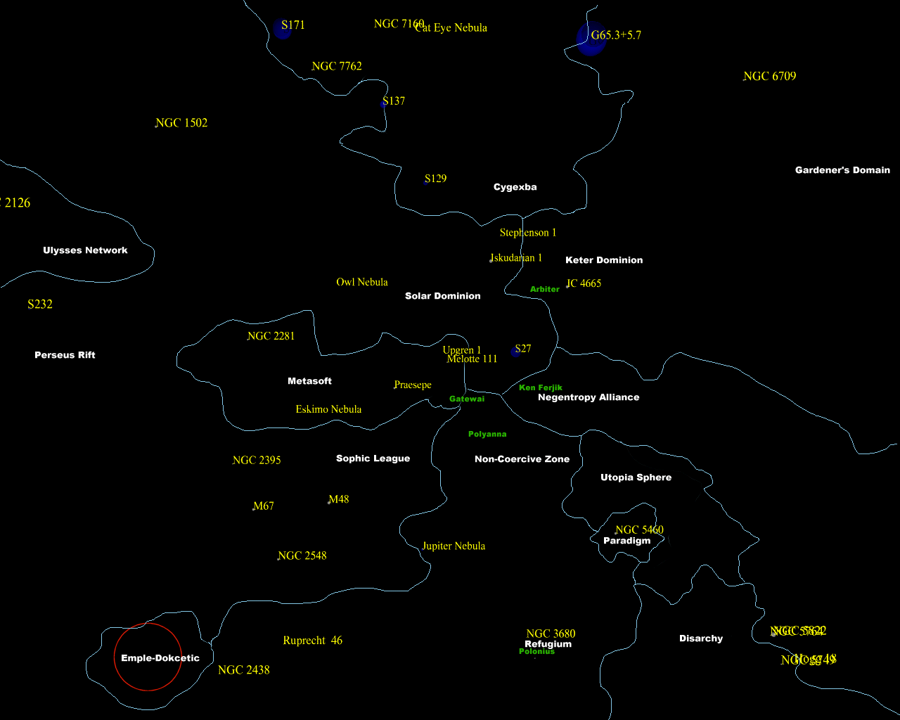
50 ly - The core of the Inner Sphere. See the Orion's Arm project for descriptions.
Yale bright stars seen along the galactic plane from 5000 ly away. Notice the diagonal band, Gould's Belt.
As we zoom in we can see the Orion arm in the center, with faint hints of the Perseus arm to the left and the Sagittarius arm to the right. Especially notable is the big complex of clouds linked with the Orion nebula/Barnard's loop, and the big but loose stellar associations close to the sun.
For more information about the objects, see SEDS.
30 June: I found a nice database of clusters at HEASARC,
which I incorporated. Some maps, as above but with the new objects:
When you plot only the open clusters, the stellar arms become visible (with some imagination): 40000 ly view. The Orion arm is at the center, extending upwards and downwards with a ~30 degree slant. To the right, below the red axis part of the Sagittarius arm can be seen (the upper right quadrant is largely obscured by dust). To the left in the upper quadrant the Perseus arm can be seen.
The scene seen
from 1000 lightyears away
The scene seen
from 500 lightyears away
The scene seen
from 250 lightyears away
The scene seen
from 100 lightyears away
I also tested using the Yale Bright Star map, which resulted in the following view from 500 ly away (only stars closer than 300 ly have names; they are slightly offset due to the naming format). Source code.
This is of course not a very good visualisation, but shows at least some of the distribution of notable stars. See Nyrath's pages for much more information and data that can be used.
The structure of the spiral arms. Course notes from University of Northern Iowa. Contains a nice map of the distribution of open clusters.